Projects
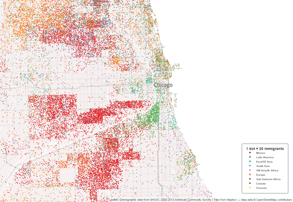
Mapping Immigrant America is an interactive dot map of the US immigrant population, designed in Mapbox Studio.
Media coverage of this project:
- A Colorful Dot Map of America’s Immigrants (CityLab)
- This colorful map illustrates where Boston’s immigrants live (boston.com)
- Immigrant America (FlowingData)
- The Week In Data: Immigrants, Executions, And Apple-Induced Heartbeats (FiveThirtyEight)
- Interactive maps pinpoint Boston’s immigrant enclaves (New Boston Post)
- This map reveals the hidden geography of immigration in Louisville and across the United States (Broken Sidewalk)
Locating neighborhood diversity in the American metropolis
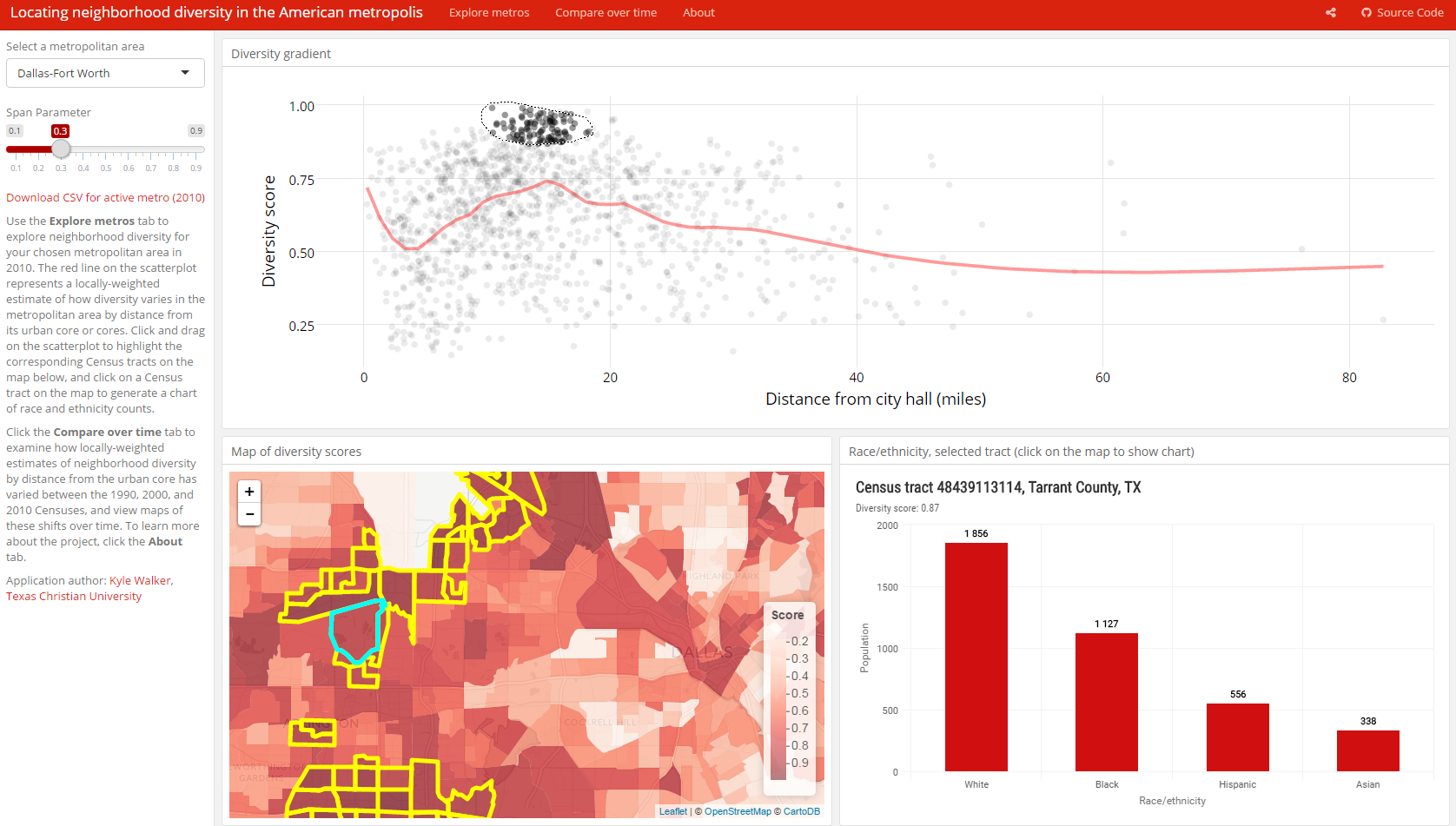
Interactive Shiny application to share some of the results of my research on diversity in US metropolitan areas.
Media coverage of this project:
- Where Are the Most Diverse Neighborhoods? (CityLab)
- UT report: Rising costs, school woes push blacks to leave Austin (Austin American-Statesman)
tigris is an R package that allows users direct access to US Census Bureau geographic datasets with minimal code, and includes some functionality to help users work with these datasets in their R projects.
Examples of tigris in action:
- Manipulating and mapping US Census data in R using the acs, tigris and leaflet packages - Zev Ross
- The Season for Sharing Data: Working with the newly released Census 2010-2014 ACS 5 year data in R - UC Berkeley D-Lab
idbr is an R package that gives R users access to the US Census Bureau’s International Database API, which includes data on both historical and future projections of international demographic indicators.
Examples of idbr in action: